The Vault Regulars

Saturday, March 2, 2024

The Gateway to the Southern Pennines.

Wednesday 28th February 2024 

Or so the area board says. 

I for one had never considered it to be the gateway but there are certainly lots of nice gates on the walk around the reservoirs and beyond.


It was good to find the car park adjacent to Ogden Reservoir was free and the toilets open from 8am to 8pm also free. Well done Oldham Council. 

We set off east along a narrow road passed the old Spring Mill. The mill looked shut but maybe repurposed as a storage facility. I don't think the mill is too old as it isn't on the 1840-1880 OS map and neither is the Ogden Reservoir.

Spring Mill.

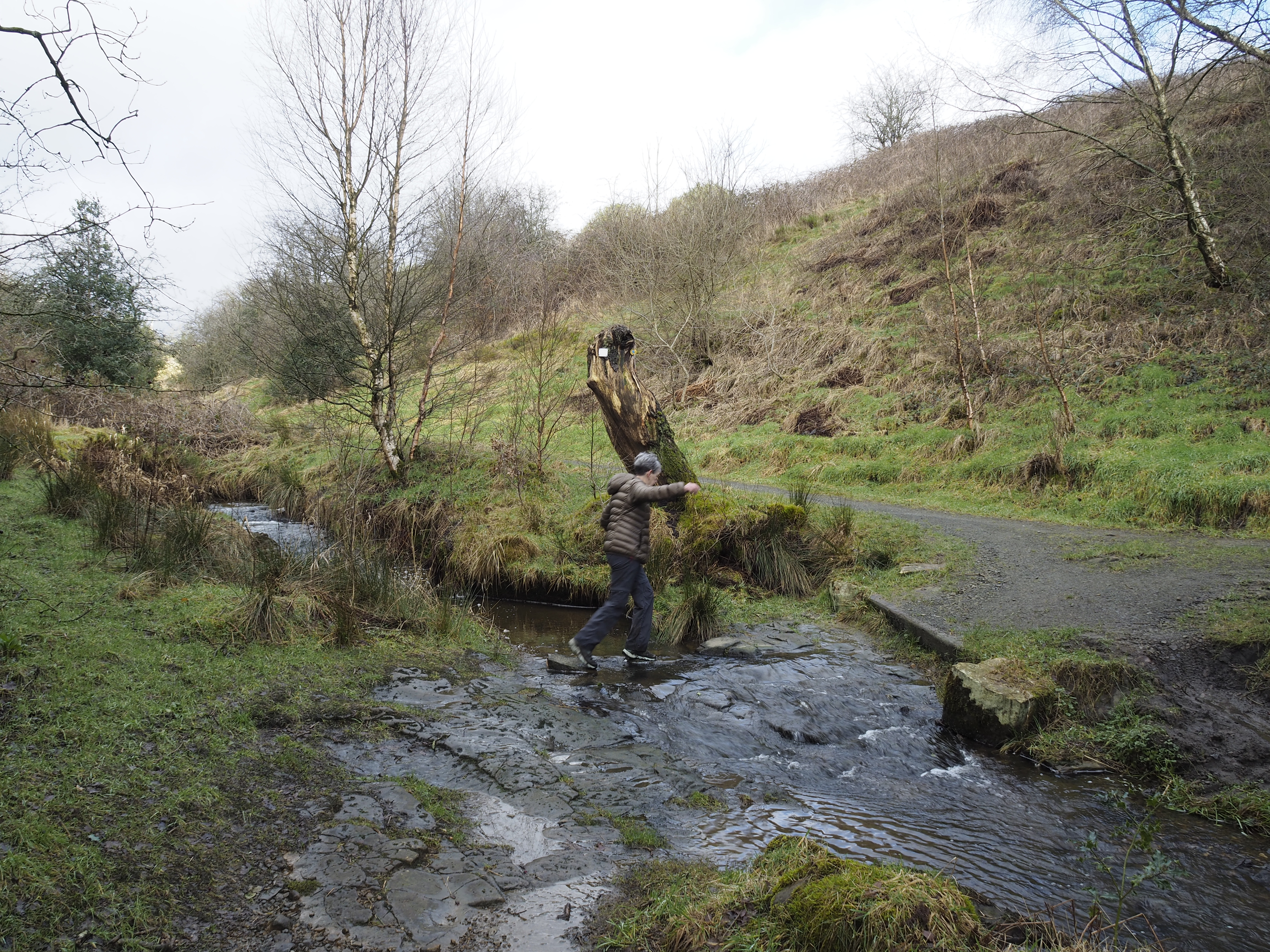
A little further along we came across a spring which had been nicely built around. Did it have any relevance to the name? I have since found out that this "spring" is actually part of a culverting system.


Notice the stone footpath arrows above the spring. There are many of these fantastic signs along the route. Never need replacing. Another good move from Oldham Council.
We chatted to three local dog walkers who were impressed with Sheila looking at a map. Very professional they said, blind as a bat, I said. We had a good laugh about navigating with the sun and the stars and then we bade farewell.


Signage on the trees gave me a bit of an impression I wasn't welcome to advance.
Our only view of Ogden Reservoir was through the woodland. We would have to wait until we got round the other side before getting a full view.

Our first view of Kitcliffe Reservoir.

There are six reservoirs in this area which were built during the late 19th centuries taking advantage of the vast amount of rainfall and sodden moorland. Built to supply power to the mills, six I believe were in this vicinity and also to supply water to Oldham and Manchester. They were built following the Oldham Corporation Gas and water act of 1855. Strangely, the lowest reservoir and nearest to the mills was built last.
  • Norman Hill Reservoir
  • Hanging Lees Reservoir
  • Piethorne Reservoir
  • Kitcliffe Reservoir.  
The above were built between 1858 and 1866. 
  • Ogden Reservoir
Was built 1872-1878
  • Rooden Reservoir (which we didn't walk past today)
Was built 1894-1901.

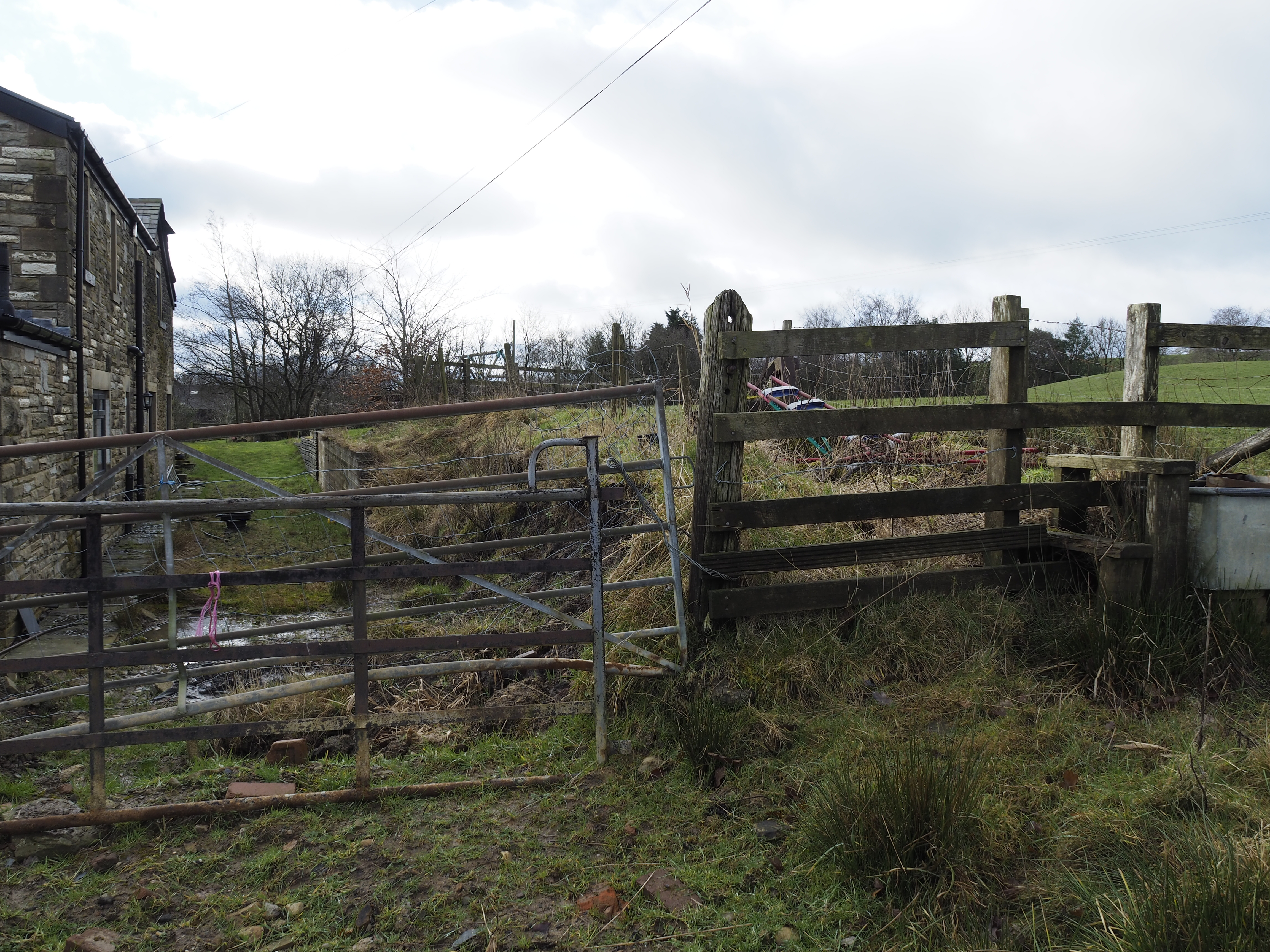
A footpath follows Ogden Reservoir boundary wall down to Kitcliffe farm which prior to the reservoirs being built was a Fulling Mill with its own water supply. It may be interesting going down to see if anything remains of the old mill but today it wasn't in the plan.

Carrying on eastwards the large expanse of Piethorne was next. There was a resident fly fisherman which we watched for a few minutes. He didn't seem to have caught anything. Fly fishing has always fascinated me but I've never had a go at it.

You will notice on the left gate post the OS bench mark. This was the first we had spotted but the OS listing shows a couple that we had missed.
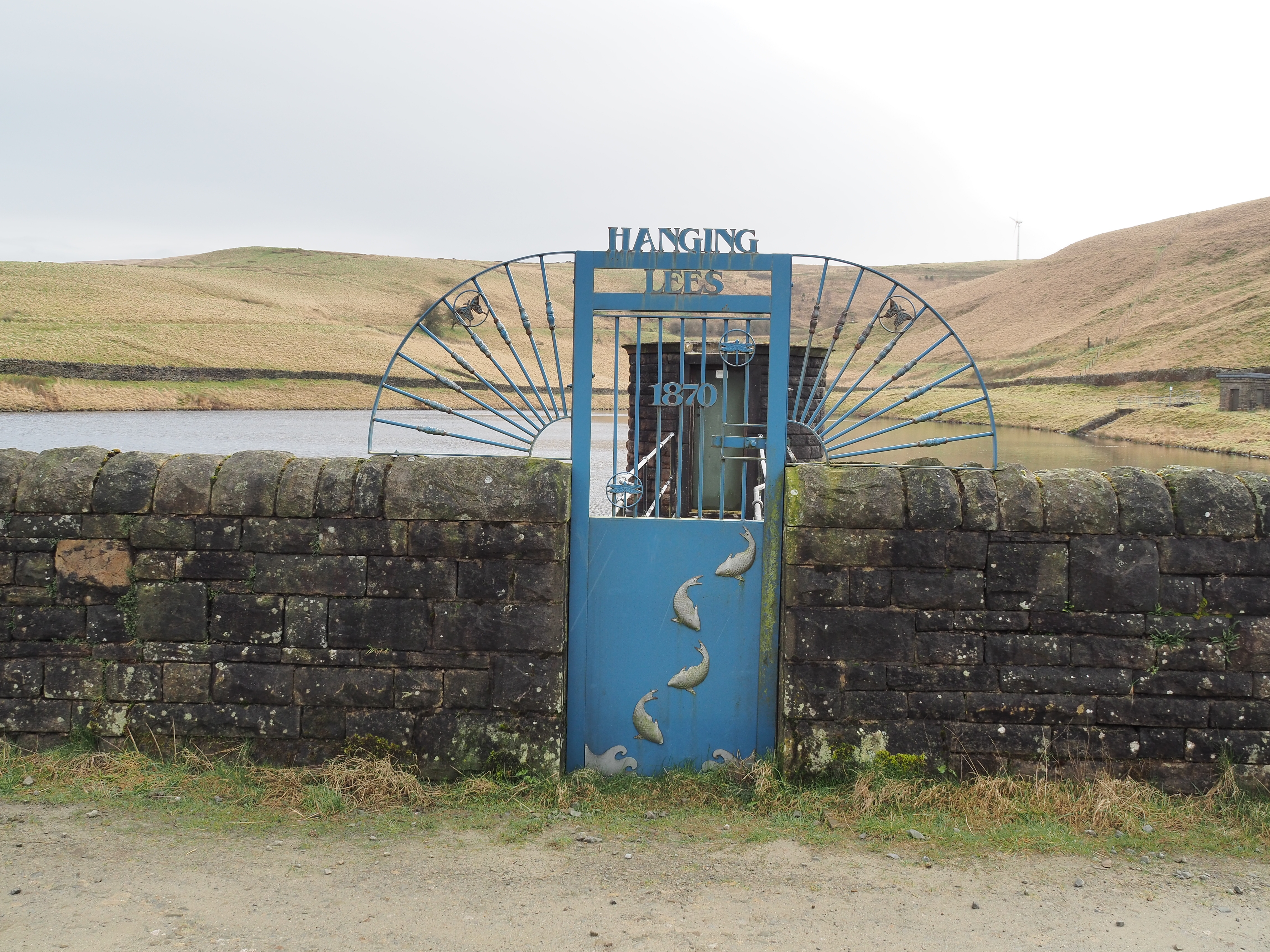
Ornate sluice system.

it was quite a pleasant day. Where was the forecast rain? I wanted it to rain to test out a new walking jacket that I had purchased from Decathlon. The clouds in front of us looked ominous but over the next 10-15 minutes we only had a very light shower. 
We got to Hanging Lees reservoir and spotted another bench mark and more ornate gates. Also, but quite a distance away was a pair of Tufted Ducks. 


Tufted Ducks.


Our path crossed between Piethorne and Hanging Lees and led up to a junction with the Pennine Bridleway. We met three mountain bikers who were finding the gradient tough but all credit to them they did it with a bit of huffing and puffing.

We couldn't get directly up to Norman Hill Reservoir because there is no public footpath around it, so we had to make do with a photo from behind the boundary wall. Norman Hill was originally a farmstead which disappeared with the building of the reservoir. It must have been a bleak spot in winter years ago.

Norman Hill Reservoir with Holme Moss mast in the distance.


Aeration waterfall from Norman Hill to Piethorne. 
Piethorn gets its name from Magpies and Hawthorns of which many were in the area.

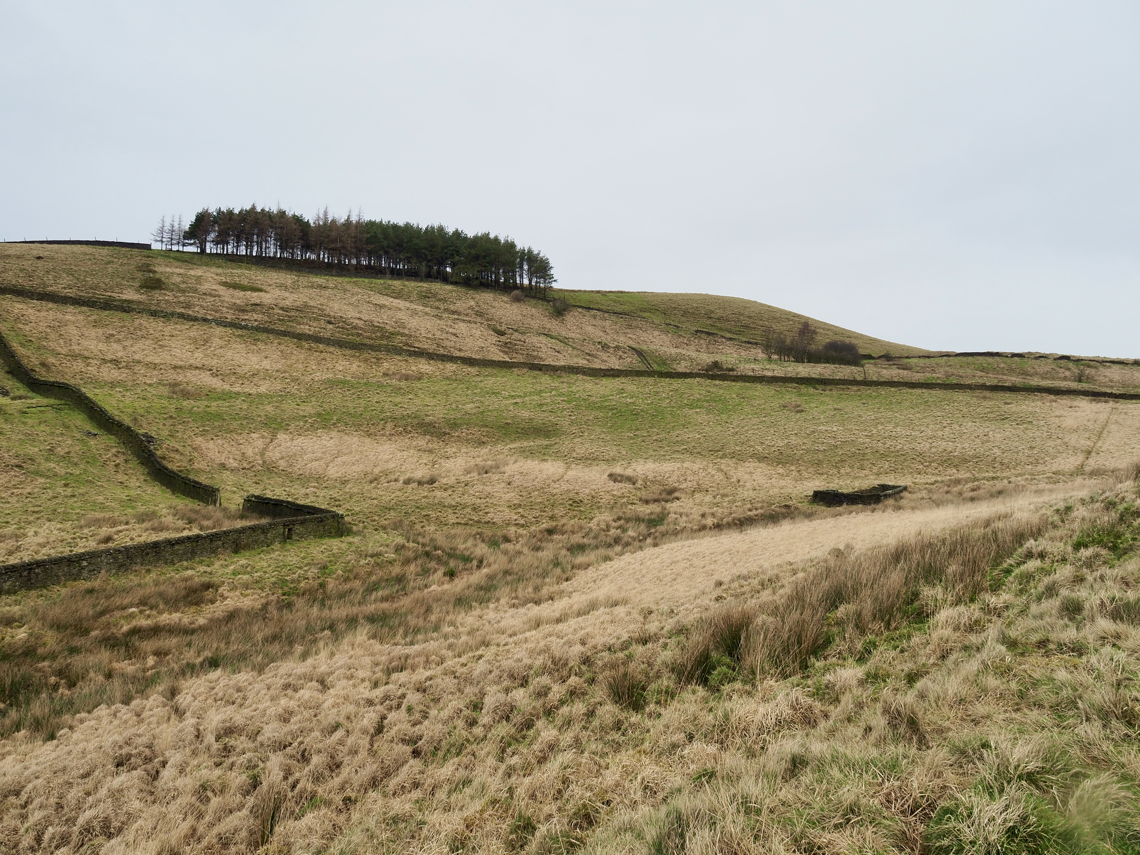
Through a gate we steadily made our way up hill passing three more ruined farmsteads, First Roughfield farm with Piethorne off to the right then a little further the farm called Close. Not much is left to see apart from some fragments of stonework if you look hard enough.

What was left at Close farm with Rooden reservoir in the background.

A kestrel searching the ground around Piethorne.

We were on a good path called Tunshall Lane which is an ancient pack horse route with high walls on both sides. Approaching Town Hill we noticed the destruction caused by off road bikes. We was going to go up there but decided it was too muddy and so stayed on the green lane.

Red lichen covering the old walls.

Sheila on Tunshall Lane.
Hillside destruction.

Another shower didn't last long but the wind as we approached the highest point of the lane was bitterly cold. We got a move on. Good views were had looking north towards Littlebourgh, with the M62 motorway bridge in the foreground and Hollingworth Lake in mid ground.


The lane headed off towards Milnrow but we headed down, back towards Ogden Reservoir. On the way we stopped to look within the remains of another farmstead called Rag Hole. This farm was a busy place in the mid 19th century where it grew crops. By the 1940's thinks were changing and the farm was  almost derelict.

Above and below, 2 shots of Rag Hole farm.


On the way down to Ogden 


The route back to the car was across the dam.

All in all this was a nice walk. Pity it didn't rain as forecast but that the fickle weather we have.

Our route. Anticlockwise from the flag marker.


I


Tuesday, January 30, 2024

Ashworth and Naden Valley circular.

 Tuesday 30th January 2024.

We took advantage of a forecast good weather day to walk an area which we had never been to before. I picked a circular route and I admit it turned out tougher than I had envisaged when I originally planned the route a couple of weeks ago. 

We parked up at the southern end of Ashworth Road at SD 852123, adjacent to a road bridge over Cheesden Brook.

Walking back along the route a 100 metres, the track we wanted entered a wooded area through where a signed pointed out that there was a danger of steep cliffs. 


The path up to the top of the escarpment was not that steep but quite slippery. It led onto farm land with a permissible path skirting Dobb wood. Good views were had towards the outskirts of Bury and further on the skyscrapers of Manchester City centre. 


We followed the path until at a cross road of paths we found a stile taking us back into the woods. Our path took us down hill to a footbridge over the brook. We saw our first person of the day here. He was a bush crafter and was heading to a makeshift shelter a hundred metres further on. He was staying here for the night and gave us some interesting facts about the area. 
We wished him well and carried on to a point where we had to cross Cheesden Brook. 

The brook was swollen with all the resent rain and although it could have been waded if absolutely necessary, we were not prepared for it. No over trousers, no gaiters, no walking poles and so decided to go back to the bridge and find a route on the other side of the brook. After a bit of searching and bramble tripping we did find a route which put us nicely back on track with dry feet.

Footbridge over Cheesden Brook
Cheesden Brook, a little too deep to cross today.

The path climbed back up to the escarpment edge with great views down to the brook, the drop was around 120 metres. Eventually we came to habitation in the form of property converted from what used to be an old dye works at Kershaw Bridge. There were far more buildings here than what survives today.
Prior to being a dye works, the buildings which now are few was built as a fustian mill by Thomas Allanson in 1780. By 1840 the buildings were a dye works until being sold to the Whitehead family and converted to cotton production.

Entrance to the now demolished Kershaw Bridge dye works.

With hindsight I wish I had walked through the path above but our trail today headed off to the right down a well made ancient track which led to Kershaw foot bridge. Thousands of stones located on edge provided good footing for folk probably wearing clogs all those years ago. At the bottom of the path and just before the bridge we came across an old mill stone. Rather strange find considering Kershaw Bridge works didn't grind {flour}? I guess other mills here were working and using water power. (at this moment I cannot suggest where the stone came from).

Ancient track. Probably made around 1780

Kershaw Bridge over Cheesden Brook.

Mill stone located near Kershaw Bridge.

The area around Kershaw Bridge looked very interesting and worthy of a revisit in the future.
Cheesden Brook.

Kershaw Bridge from the north bank.
The weather was holding out but black clouds loomed from the north west. One minute we had sun and the next we thought it was going to rain. Fortunately we didn't get rain.
From the north side of the bridge we headed up a good track where we were startled by a mountain biker who came behind us at a fair pace. There was an apology for making us jump and no harm done.
At the junction with a minor road we turned left until we came to the entrance way to Green Gate Hill Farm.

Cheesden Brook.

Sheila crossing an unnamed tributary of the brook.


The next section is one of those sections that you wish you hadn't planned and there was no alternative once we had got started.

We checked the map as we were going through a farm and wanted to make sure we were on the right "path". To the left of the buildings the map showed the route, but this looked like we were crossing a lawn, there were no other footprints and no diversion signs. We did our best not to cause damage as the ground was very wet. A tall double gate was in front of us and a high bank on the opposite side to the house. An old stile appeared at the top of the bank but looked like it hadn't been used for years. With difficulty we ascended the double gate and got onto the bank and over the stile. 

Now where do we go from here? It wasn't obvious. Down hill to a stream looked a quagmire. Check the map. The path shows this side of the stream. Another double gate, no stile. We had to climb the gates and headed east towards a wooded gully. We came to a narrow path, it could be a footpath or could be a sheep path, anyway we found a crossing over another stream with a kind of stile on the other side. I checked the map and it looked good. We got the impression rightly or wrongly that the owners were not enamoured by walkers. It would be section we would try and avoid next time.


It looks easier in the photo than it actually was.

No stile, couldn't open the gates. No indication that the path went this way.

The stream and stile on the other side. We did get wet feet on this one.

The path on the other side led us to Lee Holme farm and it was supposed to be a bridleway. A good gate takes us to the north side of the building and again no signs leading you through the yard. We didn't go through a high cattle gate just past the farm house because we thought it just led to a holding pen. As it happened we should have gone through it and avoided 100 metres of deep cut mud fest. Regaining the right path and another mud fest we hand railed a small beck on our left which brought us down to a newly fitted footbridge across Mill Croft Brook.


Just beyond this new bridge the mud fest ended for a while. The gorge became more picturesque and there is much history here. Much more than I have time for in this blog post. However, just round the corner from this bridge we passed a modern curved bridge and the remains of an old mill.

The mill turns out to be what is left of Coal Bank Mill.


What remains of Coal Bank Mill.


Coal Bank Mill after the fire of 1916.

Old York stone cart tracks leading to the mill from School Lane.
It was a good path down to school lane and lovely views following the brook. Looking at the water courses with deposits of iron oxide I guess there were also coal mines here too.

Turning left and sharp right before the bridge over Naden Brook we walked through smart high gates. A new house was being built and the path skirted the left boundary leading to another mill and waterfall. It was lovely here. The mill was the remains of Ashworth Mill.

Ashworth family mill. Remains of.
Waterfall adjacent to the mill. (Man made for the mill)
There is a water wheel here but on this occasion we didn't search for it.


Just beyond the mill the os map is wrong. It shows a path heading upwards through the trees and dropping down through Carr Wood. This path does not exist. The path follows the course of the brook and I have shown the route on the maps at the end of the post.
The route is a lovely one with many falls, twist and turns etc. A fine stretch.

Here are photo's of the walk down this bucolic gorge.


At the end of the gorge the path enters a park home site which took us a little by surprise as the path on the map carries on until it reaches the main road towards Bury. This path doesn't exist in reality.
So through the park we went and so back to the car.


Looking back from where we had come. 
Through the little side gate and to the end of the home on the left.


The purple line path between "A" and "B" is the OS map route whereas the path on the ground is actually the red dashed line.

The purple line between point "C" and the flag (E), is non existent and you have to take the route in red between "C" and "D".

Our route. 9km. 3hrs. (seemed longer due to the mud and the back tracking). 

A worthy route if very muddy in places. I can't wait to go back to investigate all the old mills and industrial revolution sites.


Find it Here

About Me

My other blog. beneathwhosefeet.wordpress.com